The Plan
A Lower Sabine River Kayak Trip never entered my mind until a few friends proposed the idea a few months ago. We set a date and everyone settled back into work and life. However not really thinking about it too much. Eventually when the date arrived. Therefore all six of us made the final preparations for a journey down the Lower Sabine River.

The River
The Sabine forms a goodly portion of the border between Texas and Louisiana, and the section we planned to run was below Toledo Bend Reservoir and would consist of ~25 miles of twisting channel.
The Lower Sabine River plays a key part in the development of east Texas. The area was important to a Clovis people and the Caddo culture. The Caddos lived along the river until about 1300 A.D. Eventually with the arrival of the Spanish, the Lower Sabine River became the eastern extent of provincial Spain in Texas. During the later development and arrival of more European settlers to the region, the Lower Sabine River was vital in the transportation of lumber and other goods from the deep Piney woods to the ports of Beaumont, Port Arthur and Orange.
In 1949 and 1950 the states of Texas and Louisiana both formed River Authorities to manage the resource. As a result, the construction of Toledo Bend Reservoir began. The multi-purpose dam provides for flood control, water conservation and hydroelectric power. Subsequently the dam was completed in 1969.
Day 1
I digress, so back to the journey which began on October 3rd.
The section of the Lower Sabine River that was of interest to us was about 10 miles below the dam. A sparsely populated region of pine lowlands straddles both sides of the river. We began our trip from a point on the River where Texas Hwy 63 crosses the river and turns into LA Hwy 8. With all the required equipment and necessities, we dragged the kayaks down to the river and shuttled all the vehicles to our take out point on the Louisiana side of the river, about 27 river miles downstream. Once we returned, with a final check of the kayaks and fishing gear, we slid off and entered the current.
The river was higher than anticipated as a result of large discharges from power generation at the dam. Finding a high and dry beach to camp on was a nagging concern to some in the group.
The Weather
We had spent the previous night in a lake house on Toledo Bend, kindly provided by one of our party. We were blessed with spectacular weather after an explosive night of thunder, lightning and heavy rain from the passage of a cold front, . Crystal blue skies, light wind and low humidity were the order of the day. After a cool morning, the sun warmed our faces and the sand. The water in the river was still warm from summer. The forecast promised clear warm days in the mid 80’s and cool nights in the low 50’s. There was no rain in the forecast.
Fishing
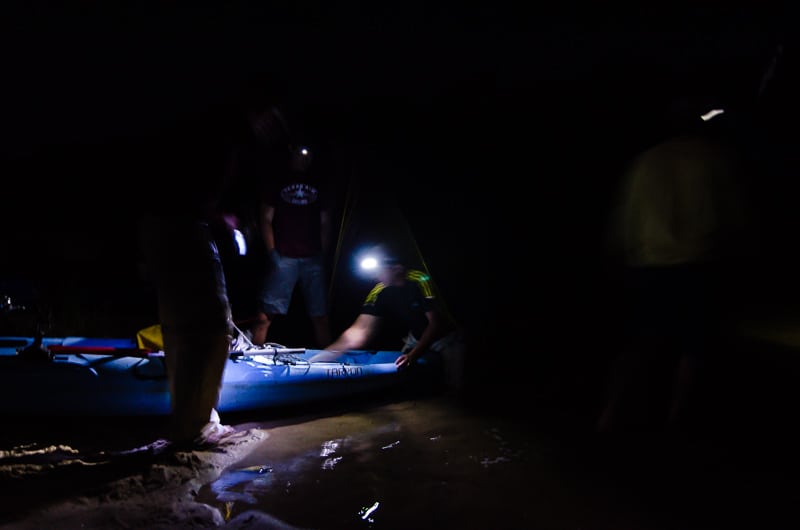
Fishing was a major activity while we floated with the current along steep-cut sand banks that alternated from the Texas side to the Louisiana side. Soon, all had caught a least a few fish and we relaxed to enjoy the scenery and the sport. Because we started late in the day, the plan was to make as many miles as possible before dark, and still find a beach to camp. We finally found a high and dry bench of white sand to stop for the night after passing many beaches that were inundated. 19:00 was approaching and we quickly pitched camp and started a fire before nightfall. The highlight of the menu was grilled fish tacos made from freshly caught bass. Afterwards the temperature quickly dropped and we retreated to our tents and sleeping bags.

Day 1 Photos


We had pushed hard that day and logged 9.77 river miles.

Day 2 Morning
A lower Sabine River Kayak Trip continued after a cool and clear might with a bright waxing moon. We awoke to a beautiful morning. The river had dropped many feet during the night and the mist was rising off the water. With a pot of percolator coffee bubbling on the stove, I walked the beach and enjoyed the still air, the calls of birds in the distance, the hammering of pileated woodpeckers and the rush of a flock of Blue winged teal rocketing up the river.


Day 2 Activities
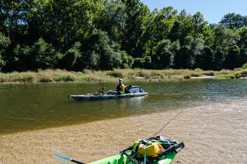
We fished most of the day with frequent stops on convenient beaches to rest and stretch a bit. The fishing was good and we caught enough for another dinner. I don’t think this stretch of the river sees much pressure. The bass were not too particular on what they liked and hit on many different artificial baits. A couple of the guys tried with little success to check up on college football scores, but cell service is spotty at best. Text messages went out occasionally. However more than that is definitely hit and mostly miss.


Day 2 Camp
We made camp about 18:00 and gathered wood for a fire and dinner. Decent wood for a fire was surprisingly hard to find. Most of the deadfall was either wet, or rotten. We ended up chopping down some river birch to feed the fire. Fresh fish tacos were again on the menu. We sat around the fire swapping stories and sipping fine whiskey before bed.


The temperature again dropped under clear skies and a bright moon and I curled up and slept deeply after a long day.
We made a bit over 9 miles on day 2, giving us time to relax and enjoy the trip and still make camp before dark. What struck me about the day was the clarity of the water and the lack of anyone else on the river. The beautiful white sand bars were also something that I did not expect. The clarity of the water is due to the surrounding subsurface being almost 100% sand. We did encounter 2 canoe travelers on day 1, but we did not see another soul on this day.
Day 3 Morning
The final day started with a thick mist rising off the river, creating a surreal scene in the quiet morning. It was cool and damp and the river had risen and receded again overnight. The River Authority adjusted the power generation schedule. We coaxed our campfire to life again and had a breakfast of grilled sausages and tortillas. Once packed up, we dragged the kayaks about 40 yards to the water and slid in for our final day on the river. We estimated we had an additional 6 or so miles to go, but I suspected with the twists and turns it would be somewhat more.


Day 3 Activities
We fished both banks of the river and stopped frequently for stretching, nature calls, and photos. In addition we explored a few side channels and a larger bayou entered the main river channel.
At mile 23.2 we stopped on a really sweet sandbar. We snacked and rested before make the final push to the terminus of the journey. This was the first day that we really had any wind and it had switched around from the south. There were occasional wind channels flowing up river that made progress slower and required some strategic positioning and some shoulder work to reach our take out.


The pullout
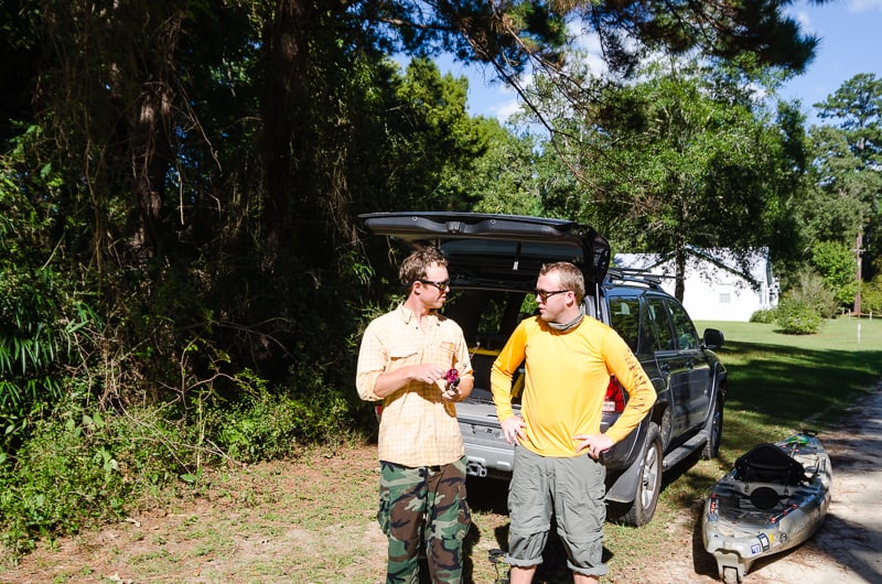
We finally reached the point at which my GPS said should be our takeout and we found the small gully leading up and out of the river. The tally for the day ended up at ~ 9 miles with some paddling required against the south wind. After unloading most of the heavier gear, we dragged the kayaks the 100 yards to our vehicles and with that the journey was completed. Loading up, we said our goodbyes and gave out a prize to one of the guys who fished with less than adequate gear for the whole trip, but held his own admirably.
Heading Home
The drive home took just over 3 hours and I arrived with a sense of satisfaction. That was a really good trip. Why haven’t I been there before? I hope you enjoy the post and if you have any questions, hit the comments tag at the beginning and blast away.

Trip Summary:
Total elapsed time – 2 days 1 hour and 48 minutes
Total distance 27 miles
I have a link here to a Google Earth .kml file for those who would like to see more detail and below is simple topo

Me and a girlfriend of mine are fixing to take a jet ski trip down the Sabine River in a couple of weeks. This will be our first time. Any advice for at night. A little worried about hogs cougars that sorts of stuff. We will have guns, and mosquito nets. Any other advice you have For us as our husbands will not be with us. They think we’re crazy LOL
You’ll be fine! Critters won’t bother you at night. Cougars…non existent. Hogs are shy. Find a nice white sandy beach and have a nice campfire…..be careful with floating debris in the water. Check the release schedule for the dam and make sure you camp high enough above the water. The river cycles up and down with releases from the dam and sometimes it can be dramatic.
We are planning to to this trip on our jet skis. Any advice/recommendations for us.
Have fun!
Great post!! Thanks for the info.
Just completed a slightly longer version of this trip, starting at the reservoir. The river looked to be several feet higher and was moving pretty fast, but aside from having to dodge a few thunderstorms on the second day it was a great trip 🙂 I couldn’t find any public river access at the takeout show in these maps, but we managed to make it work. Thank you for the well documented write up, pictures, and maps.
Glad my post was helpful. The Sabine is a great trip! The water level is highly variable with the release/power generation schedule.
HI there — I was excited to find your post and description. I’m planning on leading a group of 12 on the same stretch in a week and had a few questions that I hope you could answer. I am used to trips on more western rivers through BLM/NFS lands, so I was wondering about regulations/etiquette on this stretch — it looks like you just pulled up on any beach you liked and stayed the night — is that the case? Are there some beaches where private landowners need to be consulted? Are there any other regulations I should be aware of (again, I’m used to checking in with a ranger and having to show this, that, and the other thing before getting on the river, so this feels a little strange…) Thanks for any info you can offer!
I sent you an email…Enjoy the river, it is a great trip. Check the Lower Sabine River Authority web page for water release schedules. ALWAYS pull your watercraft way up on the beach at night, just in case they release water….Don’t want your canoe or kayak to be gone in the morning!
New to kayaking but very determined. I want to do this trip. It looks beautiful and so peaceful! I have been looking for a place to go. I don’t have my own kayak yet. Can I rent from someone?
Yes it is a great trip. Surprisingly beautiful… I know there are places in Houston that rent kayaks (Fishing Tackle Unlimited?).
You can rent canoes from a local outfitter :
Tack-A-Paw Expeditions
2340 Toro Road
Anacoco, LA 71403
Phone: 337-286-9337
Thanks for the info.
Great blog! A few of us are thinking of running a similar trip when the it cools off this year. Can I inquire into the logistics? Were you able to park your trucks safely at the top and bottom? Did you use a shuttle/outfitter?
Thanks!
We parked at the take out point. A local “outfitter” has some property on the La. side of the river and he shuttled us back to the put in point. Let me know if you need a contact number.
That looks like an awesome trip. I’m gonna try and do it in a few weeks. Could I get a contact number for the outfitter you used?
The outfitter is
Ricky Wyatt
Adventure Canoe
(337) 375-2395
Man this sounds like an awesome trip! A couple of friends of mine have been into kayaking for several years now and in 2015 this was to be one of our trips…the Sabine River! It was flooding in May and early June so we didn’t get to go but this next year, 2016, here we come. I loved the commentary and the photos were awesome. If you want a really good trip, try the Ouachita River in Mena, Arkansas…anytime in May and early June are awesome! if you want the best trip call Frank at Two Spirits Canoe Rental for shuttle service…but you get to bring your own gear and its great fishing.
Yes it is a great trip on the Sabine. Thanks for the tip on the Ouchita!